

Belgard Church Reparations and Maps
A large part of visiting the archives was to discover what information each type of record contains. The video below shows what can be found in church reparation documents.
The book shown in the video is “Bauten und Reparaturen an den Kirchen-, Pfarr- und Schulgebäuden zu Belgard Vol I.” The pages inventory what is needed to repair the church and its buildings, possibly after damage in the Napoleonic Wars since the book’s date range is 1811-1821.

This map details the area around the church. The parsonage is shown on the left with the front to the street shown at the very bottom. Each “Stube” is a room. The “Saal” is a hall. The “Durch fahrt,” which is the passage into the courtyard square, is surrounded by the “Stallung” on each side, which are stables. Rooms labeled “Cammer” are chambers and “Kuche” are kitchens. The “Fluhr” is a corridor. On the right, the street leads to the city walls. The below document is the page prior to the map, dated November 16, 1812.

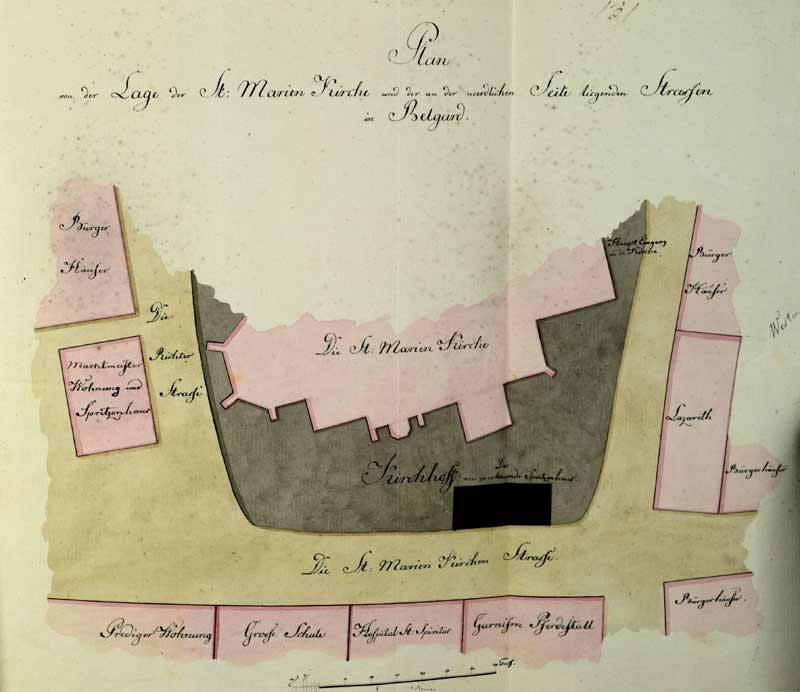
Below, the map shows the surrounding area of St. Marien Kirche. The pages following it are from December 12, 1819, so it is reasonable to assume the map is from the same year or similar time frame. The north side is at the bottom with west on the right.

It is important to note that these types of documents do not appear to have any relevance to genealogy, as there were no lists of people or rosters of tithing to the church that I could find.
